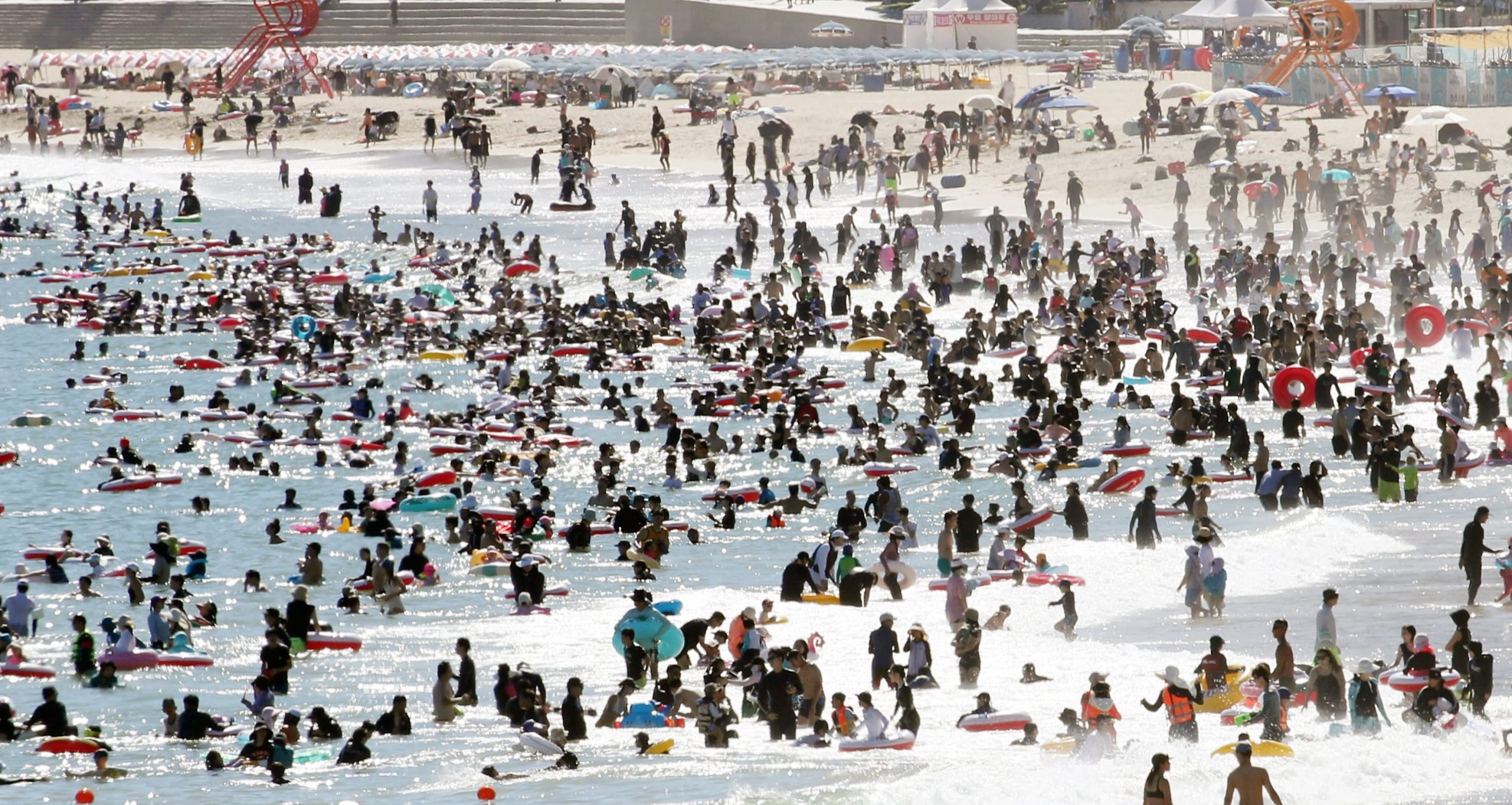
Record-Breaking Heatwave Sweeps South Korea
South Korea is experiencing one of the most intense heatwaves in recent history, with temperatures reaching unprecedented levels. On July 27, Anseong in Gyeonggi Province recorded a scorching 40.6°C, marking it as the highest temperature ever measured in the country. This extreme heat is expected to continue, with Seoul forecasted to surpass 40°C for the first time this week. The situation is compounded by tropical nights and the potential for new records.
The Korean Meteorological Administration (KMA) has identified the cause of the rising temperatures as the combined influence of the Tibetan High and the North Pacific High. These high-pressure systems are exerting significant pressure over the Korean Peninsula, creating conditions that trap heat. Additionally, trade winds, which become hotter as they cross the Taebaek Mountains, are contributing to the intensity of the heatwave. Experts compare the current situation to the extreme heatwave of 2018, when Seoul recorded a high of 39.6°C.
Rising Health Concerns
The health impacts of the heatwave are becoming increasingly severe. According to the Korea Disease Control and Prevention Agency (KDCA), there have been 2,311 cases of heat-related illnesses between May 20 and July 26—far exceeding the previous record since data collection began in 2011. During this period, 11 people died from heat-related causes, nearly three times more than the four deaths reported last year.
Typically, the North Pacific High covers the Korean Peninsula during summer months. However, the current overlap of two high-pressure systems is not unusual on its own. What makes this situation unique is the shape and duration of the “double high-pressure” pattern. This configuration has led to unusually high temperatures, with early July temperature records being broken in Seoul and other central regions.
Unusual Weather Patterns
The excessive heat has also led to the formation of an unusually large rain cloud, which brought temporary relief through heavy downpours between July 16 and 20. However, once the low-pressure systems moved out, the Tibetan High and North Pacific High quickly reasserted control, forming a second “double high-pressure” system this month. The damp land from the rain caused humidity levels to spike, leading to even sharper temperature increases. As a result, South Korea is experiencing two rounds of extreme heat in a single summer, rather than the usual one.
For several days, the country was under a layer of high pressure without the presence of hot winds. Without strong wind currents, the intense sunlight created sauna-like conditions throughout the day. The heat from the day lingered into the night, resulting in severe tropical nights.
Intensifying Conditions
This week, concerns are growing due to the addition of hot, dry winds to the already intense heat. The KMA expects trade winds and southeast winds to persist. In Korea, where the Taebaek and Sobaek mountain ranges run along the east coast, these winds become hotter and drier as they cross the mountains, bringing warm air to the western regions. A KMA official explained that the air descending the mountains becomes dry and warm, and when combined with intense sunlight, temperatures are expected to rise even more sharply.
Impact of Typhoons and Tropical Depressions
A key factor in determining the severity of the heatwave will be the impact of typhoons and tropical depressions developing south of Korea. On August 1, 2018—the hottest day of the year—both the double high-pressure system and trade winds were present, similar to this year’s conditions. However, in 2018, Typhoon Jongdari had dissipated near Japan, while a tropical depression moved toward Korea. If a typhoon moves across the peninsula, it could break the double high-pressure system, bringing heavy rain and wind that would lower temperatures. However, if the typhoon dissipates before reaching land or remains distant, the heat from the tropical air mass could intensify the already extreme conditions.
Government Response and Forecast
On July 25, the Ministry of the Interior and Safety raised the heat wave alert to its highest level, “severe,” six days earlier than it did last year. Temperatures are expected to range from lows of 21-28°C to highs of 32-37°C on July 28. The KMA forecasts that temperatures will remain above average through August 6, with no significant rainfall expected. This means continued extreme heat and persistent tropical nights throughout the period.